


..:: Previsioni WXSIM ::..
WXSIM 3in1 WXSIM EWN
| WXSIM Risk forecast for Rivalta sul Mincio, initialized at 13:00 09 May, 2024 | ||
 |
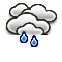
Pioggia moderata | |
| C'è un 80% di probabilità di pioggia Mercoledì. La pioggia sarà a tratti forte. Precipitazioni totali stimate intorno a 10 millimetri. | ||
| Questa previsione è basata sul rischio ed è soggetta a continui cambiamenti | ||
| Previsione a 9 giorni per rischio neve | |||||||||||||||||
| Questo pomeriggio | Oggi | Venerdì | Sabato | Domenica | Lunedì | Martedì | Mercoledì | Giovedì | Venerdì | ||||||||
| 0 % | 0 % | 0 % | 0 % | 0 % | 0 % | 0 % | 0 % | 0 % | 0 % | ||||||||
 |
|
|
|
|
|
|
|
|
|
||||||||

Next update: Thursday 09 May 2024 - 19:30
Our own forecast Rivalta sul Mincio
by: MeteoMincio
Temperature
Thunder
Sol
Wind
Max/Min Temperature
| This afternoon |
Tonight | Friday | Friday night |
Saturday | Saturday night |
Sunday | Sunday night |
 |
 |
|
 |
 |
|
|
|
| Mostly Cloudy | Partly Cloudy | Mostly Cloudy | Fog late | Fog a.m. | Fog late | Fog a.m. | Fog late |
| Hi: 25°C | Lo: 15°C | Hi: 25°C | Lo: 14°C | Hi: 26°C | Lo: 14°C | Hi: 27°C | Lo: 14°C |
 8 km/h ESE |
 4 km/h SSW |
6 km/h ESE |
 3 km/h SE |
 4 km/h E |
0 km/h E |
 4 km/h S |
5 km/h E |
| UV 6 High | UV 6 High | UV 6 High | UV 6 High |
| This afternoon | Mostly cloudy to cloudy. High 25°C. UV index up to 6. Wind east-southeast around 8 kph, gusting to 26 kph. |
| Tonight | Partly to mostly cloudy in the evening, becoming partly cloudy after midnight. Low 15°C. Wind south-southwest around 4 kph in the evening, becoming north after midnight. |
| Friday | Sunny in the morning, becoming partly to mostly cloudy in the afternoon. High 25°C. UV index up to 6. Wind east-southeast around 6 kph. |
| Friday night | Partly to mostly cloudy in the evening, becoming clear after midnight. Moderate fog after midnight. Low 14°C. Wind southeast around 3 kph in the evening, becoming northeast after midnight. |
| Saturday | Sunny in the morning, becoming partly to mostly sunny in the afternoon. Moderate fog in the morning. High 26°C. UV index up to 6. Wind east around 4 kph. |
| Saturday night | Mostly clear. Light to moderate fog after midnight. Low 14°C. Wind east near calm in the evening, becoming north-northeast after midnight. |
| Sunday | Sunny in the morning, becoming mostly sunny in the afternoon. Light to moderate fog in the morning. Warm. High 27°C. UV index up to 6. Wind south around 4 kph. |
| Sunday night | Fair to partly cloudy in the evening, becoming partly cloudy after midnight. Light to moderate fog after midnight. Low 14°C. Wind east around 5 kph. |
| Monday | Mostly cloudy in the morning, becoming partly to mostly sunny in the afternoon. Light to moderate fog in the morning. High 27°C. UV index up to 6. Wind southwest around 3 kph. |
| Monday night | Partly to mostly cloudy in the evening, becoming fair after midnight. Patchy light fog after midnight. Low 14°C. Wind east-northeast around 3 kph. |
| Tuesday | Cloudy in the morning, becoming mostly cloudy in the afternoon. Patchy light fog in the morning. High 26°C. UV index up to 5. Wind southeast around 3 kph. |
 | Tuesday night | Mostly cloudy to cloudy in the evening, becoming dense overcast after midnight. Patchy light fog after midnight. A slight chance of rain in the evening, then a chance of rain after midnight. Precipitation showery or intermittent. Low 15°C. Wind west-northwest around 3 kph in the evening, becoming north-northwest after midnight. Chance of precipitation 50 percent. Precipitation mostly around 2 mm. |
 | Wednesday | Dense overcast in the morning, becoming mostly cloudy to cloudy in the afternoon. Light to moderate fog. A chance of rain in the morning, then rain likely in the afternoon. Precipitation showery or intermittent. High 21°C. UV index up to 3. Wind northeast around 5 kph in the morning, becoming east-southeast in the afternoon. Chance of precipitation 80 percent. Precipitation mostly around 10 mm. |
| Wednesday night | Fair in the evening, becoming partly cloudy after midnight. Patchy light fog in the evening, then moderate fog after midnight. A chance of rain after midnight. Low 14°C. Wind northeast around 7 kph. Chance of precipitation 40 percent. Precipitation mostly around 2 mm. |
| Thursday | Partly to mostly cloudy in the morning, becoming sunny in the afternoon. Patchy light fog in the morning. A chance of rain in the morning, then a slight chance of rain in the afternoon. High 24°C. UV index up to 7. Wind west-southwest around 4 kph. Chance of precipitation 30 percent. Precipitation mostly less than 2 mm. |
| Thursday night | Mostly clear in the evening, becoming partly cloudy after midnight. Light to moderate fog after midnight. Low 15°C. Wind west-northwest around 4 kph. |
| Friday | Partly cloudy in the morning, becoming mostly cloudy to cloudy in the afternoon. Moderate fog in the morning. A slight chance of rain. Precipitation showery or intermittent. High 22°C. UV index up to 5. Wind west around 10 kph, gusting to 28 kph, in the morning, becoming 15 kph, gusting to 30 kph, in the afternoon. Chance of precipitation 20 percent. Precipitation mostly less than 2 mm. |
| Friday night | Fair to partly cloudy in the evening, becoming fair after midnight. Patchy light fog after midnight. Low 14°C. Wind west around 11 kph, gusting to 29 kph, in the evening, becoming 5 kph after midnight. |
Thursday 09 May 2024
 05:54 CEST 05:54 CEST
 20:33 CEST Daylength: 14:39 20:33 CEST Daylength: 14:39
| ||||||||
| Period | Forecast | Temperature | Wind | Precipitation | Pressure | UV | ||
| Afternoon 12 - 18 |
  |
Clear - Cloudy Chance Rain Showers - Drizzle |
25°C |   |
7 - 11 km/h Gust up to 33 km/h 2 Bft Light breeze |
0.3 mm | 1019 hPa |  High (5.6) |
| Evening 18 - 00 |
  |
Mostly cloudy Drizzle |
23°C - 17°C |  |
5 km/h Gust up to 23 km/h 1 Bft Light air |
0.5 mm | 1019 hPa | - |
|
Friday 10 May 2024
05:52 CEST
20:34 CEST Daylength: 14:42
| ||||||||
| Period | Forecast | Temperature | Wind | Precipitation | Pressure | UV | ||
| Night 00 - 06 |
 |
Partly cloudy Drizzle |
17°C |  |
5 km/h Gust up to 13 km/h 1 Bft Light air |
- | 1020 hPa | - |
| Morning 06 - 12 |
 |
Mostly clear | 15°C - 23°C | |
3 - 7 km/h Gust up to 26 km/h 1 Bft Light air |
- | 1020 hPa |  Medium (5.3) |
| Afternoon 12 - 18 |
 |
Cloudy Drizzle - Chance Rain Showers |
25°C | |
7 km/h Gust up to 26 km/h 1 Bft Light air |
- | 1019 hPa | Medium (5.3) |
| Evening 18 - 00 |
 |
Partly cloudy - Mostly clear | 23°C - 17°C | |
1 - 6 km/h Gust up to 23 km/h 1 Bft Light air |
- | 1019 hPa | - |
|
Saturday 11 May 2024
05:51 CEST
20:35 CEST Daylength: 14:44
| ||||||||
| Period | Forecast | Temperature | Wind | Precipitation | Pressure | UV | ||
| Night 00 - 06 |
  |
Clear Moderate fog |
16°C | |
0 - 5 km/h Gust up to 12 km/h 1 Bft Light air |
- | 1019 hPa | - |
| Morning 06 - 12 |
 |
Clear Light fog |
14°C - 24°C |  |
1 - 5 km/h Gust up to 24 km/h 1 Bft Light air |
- | 1020 hPa | Medium (5.4) |
| Afternoon 12 - 18 |
|
Partly cloudy - Clear | 24°C - 27°C | |
6 km/h Gust up to 25 km/h 1 Bft Light air |
- | 1019 hPa | High (5.6) |
| Evening 18 - 00 |
 |
Partly cloudy - Clear | 25°C - 17°C | |
4 km/h Gust up to 20 km/h 1 Bft Light air |
- | 1019 hPa | - |
|
Sunday 12 May 2024
05:50 CEST
20:36 CEST Daylength: 14:46
| ||||||||
| Period | Forecast | Temperature | Wind | Precipitation | Pressure | UV | ||
| Night 00 - 06 |
|
Clear Moderate fog |
17°C - 14°C |  |
2 km/h Gust up to 7 km/h 1 Bft Light air |
- | 1019 hPa | - |
| Morning 06 - 12 |
|
Clear Light fog |
14°C - 24°C |  |
0 - 4 km/h Gust up to 23 km/h 1 Bft Light air |
- | 1019 hPa | High (5.7) |
| Afternoon 12 - 18 |
|
Partly cloudy - Clear | 27°C | |
6 km/h Gust up to 26 km/h 1 Bft Light air |
- | 1017 hPa | High (6.0) |
| Evening 18 - 00 |
 |
Partly cloudy - Mostly clear Drizzle |
26°C - 18°C | |
7 km/h Gust up to 24 km/h 1 Bft Light air |
- | 1016 hPa | - |
|
Monday 13 May 2024
05:49 CEST
20:38 CEST Daylength: 14:49
| ||||||||
| Period | Forecast | Temperature | Wind | Precipitation | Pressure | UV | ||
| Night 00 - 06 |
 |
Mostly cloudy Moderate fog - Drizzle |
17°C | |
0 - 5 km/h Gust up to 11 km/h 1 Bft Light air |
- | 1016 hPa | - |
| Morning 06 - 12 |
 |
Partly cloudy Light fog - Drizzle |
14°C - 23°C |  |
3 km/h Gust up to 21 km/h 1 Bft Light air |
- | 1016 hPa | Medium (5.1) |
| Afternoon 12 - 18 |
 |
Partly cloudy - Mostly clear Drizzle |
24°C - 27°C | |
6 km/h Gust up to 26 km/h 1 Bft Light air |
0.2 mm | 1013 hPa | High (6.0) |
| Evening 18 - 00 |
|
Partly cloudy Drizzle - Chance Rain Showers |
26°C - 18°C |  |
4 km/h Gust up to 23 km/h 1 Bft Light air |
0.3 mm | 1011 hPa | - |
|
Tuesday 14 May 2024
05:48 CEST
20:39 CEST Daylength: 14:51
| ||||||||
| Period | Forecast | Temperature | Wind | Precipitation | Pressure | UV | ||
| Night 00 - 06 |
 |
Partly cloudy - Clear Light fog |
17°C - 14°C |  |
3 km/h Gust up to 8 km/h 1 Bft Light air |
- | 1011 hPa | - |
| Morning 06 - 12 |
 |
Cloudy - Overcast Chance Rain Showers - Drizzle |
14°C - 22°C | |
0 - 4 km/h Gust up to 22 km/h 1 Bft Light air |
- | 1011 hPa |  Medium (3.5) |
| Afternoon 12 - 18 |
|
Mostly cloudy Drizzle |
23°C - 26°C | |
5 km/h Gust up to 25 km/h 1 Bft Light air |
0.2 mm | 1009 hPa | Medium (4.7) |
| Evening 18 - 00 |
|
Cloudy - Overcast Drizzle - Light rain |
25°C - 18°C | |
4 km/h Gust up to 19 km/h 1 Bft Light air |
0.5 mm | 1009 hPa | - |
|
Wednesday 15 May 2024
05:46 CEST
20:40 CEST Daylength: 14:53
| ||||||||
| Period | Forecast | Temperature | Wind | Precipitation | Pressure | UV | ||
| Night 00 - 06 |
|
Overcast Light rain - Chance Rain Showers |
18°C | |
4 km/h Gust up to 12 km/h 1 Bft Light air |
1.6 mm | 1009 hPa | - |
| Morning 06 - 12 |
|
Overcast - Cloudy Light rain - Chance Rain Showers |
15°C - 19°C | |
3 - 8 km/h Gust up to 24 km/h 2 Bft Light breeze |
3 mm | 1009 hPa |  Low (1.9) |
| Afternoon 12 - 18 |
 |
Overcast - Partly cloudy - Clear Moderate rain - Probably showers - Chance Rain Showers - Light fog |
20°C | |
6 km/h Gust up to 21 km/h 1 Bft Light air |
8.9 mm | 1008 hPa |  Medium (2.5) |
| Evening 18 - 00 |
|
Partly cloudy - Mostly clear Light fog |
20°C - 16°C | |
8 km/h Gust up to 23 km/h 2 Bft Light breeze |
- | 1009 hPa | - |
|
Thursday 16 May 2024
05:45 CEST
20:41 CEST Daylength: 14:56
| ||||||||
| Period | Forecast | Temperature | Wind | Precipitation | Pressure | UV | ||
| Night 00 - 06 |
  |
Mostly cloudy Light rain - Moderate fog - Chance Rain Showers |
16°C | |
4 - 8 km/h Gust up to 19 km/h 2 Bft Light breeze |
2.3 mm | 1009 hPa | - |
| Morning 06 - 12 |
|
Partly cloudy Light rain - Chance Rain Showers - Drizzle |
15°C - 20°C |  |
1 - 5 km/h Gust up to 24 km/h 1 Bft Light air |
1.3 mm | 1010 hPa | High (5.9) |
| Afternoon 12 - 18 |
|
Partly cloudy - Clear | 21°C - 24°C | |
6 km/h Gust up to 25 km/h 1 Bft Light air |
0.2 mm | 1008 hPa |  High (6.6) |
| Evening 18 - 00 |
|
Partly cloudy - Clear | 24°C - 18°C |  |
4 km/h Gust up to 23 km/h 1 Bft Light air |
- | 1008 hPa | - |
|
Friday 17 May 2024
05:44 CEST
20:42 CEST Daylength: 14:58
| ||||||||
| Period | Forecast | Temperature | Wind | Precipitation | Pressure | UV | ||
| Night 00 - 06 |
 |
Mostly cloudy - Mostly clear Moderate fog - Drizzle |
17°C | |
4 - 8 km/h Gust up to 19 km/h 2 Bft Light breeze |
0.3 mm | 1008 hPa | - |
| Morning 06 - 12 |
 |
Mostly cloudy - Mostly clear Drizzle - Light fog - Chance Rain Showers |
15°C - 22°C | |
8 - 14 km/h Gust up to 34 km/h 3 Bft Gentle breeze |
- | 1008 hPa | Medium (4.8) |
| Afternoon 12 - 18 |
|
Mostly cloudy Drizzle - Probably showers - Chance Rain Showers |
22°C | |
17 km/h Gust up to 35 km/h 3 Bft Gentle breeze |
0.5 mm | 1007 hPa | Medium (4.4) |
| Evening 18 - 23 |
|
Partly cloudy - Clear Drizzle |
20°C - 16°C | |
7 - 15 km/h Gust up to 31 km/h 3 Bft Gentle breeze |
0.2 mm | 1008 hPa | - |
|
Thursday 09 May 2024
05:54 CEST
20:33 CEST Daylength: 14:39
| ||||||||||
| Period | Forecast | Temperature | Wind | Precipitation | Lightning | Dewpoint | Pressure | Humidity | UV | Zicht |
| 12 - 13 | Clear |
23,1°C | 11,0 km/h East 2 Bft Light breeze |
- | -22% | 15,3°C | 1019,0 hPa | 61 % | High (5.6) |
22,0 km |
| 13 - 14 | Cloudy |
23,2°C | 8,0 km/h East 2 Bft Light breeze |
- | 26% | 15,1°C | 1019,0 hPa | 60 % | Medium (3.8) |
22,0 km |
| 14 - 15 | Cloudy Chance Rain Showers |
23,9°C | 7,0 km/h East 1 Bft Light air |
- | 34% | 15,1°C | 1019,0 hPa | 58 % | Medium (2.7) |
21,0 km |
| 15 - 16 | Cloudy Drizzle |
23,8°C | 7,0 km/h SSE 1 Bft Light air |
0,30 mm | 38% | 15,4°C | 1018,0 hPa | 59 % | Low (1.6) |
18,0 km |
| 16 - 17 | Cloudy Chance Rain Showers |
23,7°C | 7,0 km/h SSE 1 Bft Light air |
- | 36% | 15,5°C | 1018,0 hPa | 60 % |  Low (0.9) |
20,0 km |
| 17 - 18 | Cloudy Chance Rain Showers |
23,4°C | 7,0 km/h SSE 1 Bft Light air |
- | 30% | 15,6°C | 1018,0 hPa | 62 % | - | 20,0 km |
| 18 - 19 | Mostly cloudy Drizzle |
22,3°C | 5,0 km/h SSW 1 Bft Light air |
- | 18% | 16,0°C | 1018,0 hPa | 68 % | - | 17,0 km |
| 19 - 20 | Partly cloudy |
21,0°C | 4,0 km/h SSW 1 Bft Light air |
0,20 mm | 10% | 16,3°C | 1019,0 hPa | 75 % | - | 19,0 km |
| 20 - 21 | Partly cloudy |
19,5°C | 3,0 km/h SSW 1 Bft Light air |
- | 6% | 15,8°C | 1019,0 hPa | 79 % | - | 18,0 km |
| 21 - 22 | Mostly cloudy Drizzle |
18,3°C | 3,0 km/h North 1 Bft Light air |
- | -4% | 15,2°C | 1019,0 hPa | 82 % | - | 15,0 km |
| 22 - 23 | Mostly cloudy |
17,4°C | 3,0 km/h North 1 Bft Light air |
0,30 mm | -10% | 14,8°C | 1020,0 hPa | 85 % | - | 17,0 km |
| 23 - 00 | Mostly cloudy |
16,9°C | 3,0 km/h North 1 Bft Light air |
- | -10% | 14,5°C | 1020,0 hPa | 86 % | - | 16,0 km |
|
Friday 10 May 2024
05:52 CEST
20:34 CEST Daylength: 14:42
| ||||||||||
| Period | Forecast | Temperature | Wind | Precipitation | Lightning | Dewpoint | Pressure | Humidity | UV | Zicht |
| 00 - 01 | Mostly cloudy Drizzle |
16,4°C | 4,0 km/h North 1 Bft Light air |
- | -12% | 14,2°C | 1020,0 hPa | 87 % | - | 15,0 km |
| 01 - 02 | Partly cloudy |
16,0°C | 4,0 km/h North 1 Bft Light air |
- | -14% | 13,9°C | 1020,0 hPa | 88 % | - | 16,0 km |
| 02 - 03 | Partly cloudy |
15,6°C | 5,0 km/h North 1 Bft Light air |
- | -14% | 13,6°C | 1020,0 hPa | 88 % | - | 16,0 km |
| 03 - 04 | Mostly cloudy Drizzle |
15,4°C | 4,0 km/h NE 1 Bft Light air |
- | -12% | 13,3°C | 1020,0 hPa | 87 % | - | 16,0 km |
| 04 - 05 | Partly cloudy |
15,2°C | 4,0 km/h NE 1 Bft Light air |
- | -14% | 13,0°C | 1020,0 hPa | 87 % | - | 16,0 km |
| 05 - 06 | Partly cloudy |
15,0°C | 4,0 km/h NE 1 Bft Light air |
- | -16% | 12,7°C | 1020,0 hPa | 86 % | - | 16,0 km |
| 06 - 07 | Mostly clear |
15,6°C | 3,0 km/h NE 1 Bft Light air |
- | -16% | 12,7°C | 1020,0 hPa | 83 % | - | 16,0 km |
| 07 - 08 | Clear |
16,7°C | 3,0 km/h NE 1 Bft Light air |
- | -16% | 13,0°C | 1020,0 hPa | 79 % | Low (0.5) |
16,0 km |
| 08 - 09 | Clear |
18,0°C | 4,0 km/h NE 1 Bft Light air |
- | -16% | 13,6°C | 1021,0 hPa | 75 % | Low (1.3) |
16,0 km |
| 09 - 10 | Clear |
19,5°C | 5,0 km/h SE 1 Bft Light air |
- | -12% | 14,0°C | 1021,0 hPa | 70 % | Medium (2.7) |
16,0 km |
| 10 - 11 | Clear |
21,2°C | 6,0 km/h SE 1 Bft Light air |
- | -10% | 14,1°C | 1020,0 hPa | 64 % | Medium (4.2) |
16,0 km |
| 11 - 12 | Mostly clear |
22,3°C | 7,0 km/h SE 1 Bft Light air |
- | -8% | 14,4°C | 1020,0 hPa | 61 % | Medium (5.3) |
17,0 km |
| 12 - 13 |  Partly cloudy Drizzle |
22,8°C | 7,0 km/h SE 1 Bft Light air |
- | -2% | 14,6°C | 1020,0 hPa | 60 % | Medium (5.2) |
17,0 km |
| 13 - 14 | Partly cloudy |
23,3°C | 7,0 km/h SE 1 Bft Light air |
- | 2% | 14,7°C | 1019,0 hPa | 58 % | Medium (5.3) |
17,0 km |
| 14 - 15 | Mostly cloudy |
23,7°C | 7,0 km/h SE 1 Bft Light air |
- | 4% | 14,6°C | 1019,0 hPa | 57 % | Medium (3.9) |
18,0 km |
| 15 - 16 | Cloudy Chance Rain Showers |
24,1°C | 7,0 km/h SE 1 Bft Light air |
- | 12% | 14,5°C | 1018,0 hPa | 55 % | Low (2.2) |
18,0 km |
| 16 - 17 | Cloudy Chance Rain Showers |
24,1°C | 6,0 km/h SE 1 Bft Light air |
- | 18% | 14,4°C | 1018,0 hPa | 55 % | Low (0.9) |
18,0 km |
| 17 - 18 | Cloudy Chance Rain Showers |
23,6°C | 6,0 km/h SE 1 Bft Light air |
- | 10% | 14,4°C | 1018,0 hPa | 56 % | - | 18,0 km |
| 18 - 19 | Cloudy |
22,7°C | 6,0 km/h SE 1 Bft Light air |
- | - | 14,8°C | 1018,0 hPa | 61 % | - | 18,0 km |
| 19 - 20 | Mostly cloudy |
21,3°C | 5,0 km/h SE 1 Bft Light air |
- | -8% | 14,9°C | 1018,0 hPa | 67 % | - | 18,0 km |
| 20 - 21 | Mostly cloudy |
19,6°C | 4,0 km/h SE 1 Bft Light air |
- | -12% | 14,3°C | 1019,0 hPa | 71 % | - | 18,0 km |
| 21 - 22 | Partly cloudy |
18,4°C | 2,0 km/h NE 1 Bft Light air |
- | -16% | 13,4°C | 1019,0 hPa | 73 % | - | 17,0 km |
| 22 - 23 | Partly cloudy |
17,4°C | 1,0 km/h NE 0 Bft Calm |
- | -18% | 12,9°C | 1019,0 hPa | 75 % | - | 16,0 km |
| 23 - 00 | Mostly clear |
16,6°C | 1,0 km/h NE 0 Bft Calm |
- | -18% | 12,7°C | 1019,0 hPa | 78 % | - | 13,0 km |
|
Saturday 11 May 2024
05:51 CEST
20:35 CEST Daylength: 14:44
| ||||||||||
| Period | Forecast | Temperature | Wind | Precipitation | Lightning | Dewpoint | Pressure | Humidity | UV | Zicht |
| 00 - 01 | Mostly clear Light fog |
16,0°C | 3,0 km/h NE 1 Bft Light air |
- | -18% | 12,6°C | 1019,0 hPa | 80 % | - | 5,7 km |
| 01 - 02 | Clear Moderate fog |
15,5°C | 5,0 km/h NE 1 Bft Light air |
- | -18% | 12,4°C | 1020,0 hPa | 82 % | - | 2,1 km |
| 02 - 03 | Clear Moderate fog |
15,0°C | 4,0 km/h NE 1 Bft Light air |
- | -16% | 12,2°C | 1020,0 hPa | 83 % | - | 1,3 km |
| 03 - 04 | Clear Moderate fog |
14,6°C | 3,0 km/h NE 1 Bft Light air |
- | -16% | 12,0°C | 1019,0 hPa | 84 % | - | 1,2 km |
| 04 - 05 | Clear Moderate fog |
14,2°C | 1,0 km/h NE 0 Bft Calm |
- | -14% | 11,9°C | 1019,0 hPa | 86 % | - | 1,1 km |
| 05 - 06 | Clear Moderate fog |
13,9°C | 0,0 km/h NE 0 Bft Calm |
- | -16% | 11,8°C | 1019,0 hPa | 88 % | - | 0,8 km |
| 06 - 07 | Clear Moderate fog |
13,9°C | 1,0 km/h NNW 0 Bft Calm |
- | -22% | 12,1°C | 1020,0 hPa | 88 % | - | 1,0 km |
| 07 - 08 | Clear Moderate fog |
14,8°C | 1,0 km/h NNW 0 Bft Calm |
- | -20% | 13,0°C | 1020,0 hPa | 89 % | - | 1,9 km |
| 08 - 09 | Clear Light fog |
16,3°C | 2,0 km/h NNW 1 Bft Light air |
- | -18% | 13,8°C | 1020,0 hPa | 85 % | Low (1.1) |
8,3 km |
| 09 - 10 | Clear |
18,6°C | 3,0 km/h East 1 Bft Light air |
- | -6% | 14,6°C | 1021,0 hPa | 77 % | Medium (2.7) |
15,0 km |
| 10 - 11 | Clear |
21,2°C | 4,0 km/h East 1 Bft Light air |
- | -4% | 15,0°C | 1020,0 hPa | 68 % | Medium (4.2) |
15,0 km |
| 11 - 12 | Clear |
23,1°C | 5,0 km/h East 1 Bft Light air |
- | -2% | 15,1°C | 1020,0 hPa | 61 % | Medium (5.4) |
16,0 km |
|
Thursday 09 May 2024
05:54 CEST
20:33 CEST Daylength: 14:39
| ||||||||
| Period | Temperature | Rain | UV | Solar | Temp+10 | Surface | Soil 1 | Soil 2 |
| Afternoon 12 - 18 |
25°C | 0.3 mm | High (5.6) |
876 W/m2 | 26°C | 21°C | 20°C | 19°C |
| Evening 18 - 00 |
23°C | 0.5 mm | - | 105 W/m2 | 17°C | 19°C | 19°C | 19°C |
|
Friday 10 May 2024
05:52 CEST
20:34 CEST Daylength: 14:42
| ||||||||
| Period | Temperature | Rain | UV | Solar | Temp+10 | Surface | Soil 1 | Soil 2 |
| Night 00 - 06 |
17°C | - | - | 6 W/m2 | 13°C | 17°C | 18°C | 18°C |
| Morning 06 - 12 |
23°C | - | Medium (5.3) |
780 W/m2 | 23°C | 19°C | 18°C | 18°C |
| Afternoon 12 - 18 |
25°C | - | Medium (5.3) |
725 W/m2 | 27°C | 22°C | 20°C | 19°C |
| Evening 18 - 00 |
23°C | - | - | 97 W/m2 | 16°C | 19°C | 20°C | 19°C |
|
Saturday 11 May 2024
05:51 CEST
20:35 CEST Daylength: 14:44
| ||||||||
| Period | Temperature | Rain | UV | Solar | Temp+10 | Surface | Soil 1 | Soil 2 |
| Night 00 - 06 |
16°C | - | - | 3 W/m2 | 13°C | 18°C | 18°C | 18°C |
| Morning 06 - 12 |
24°C | - | Medium (5.4) |
806 W/m2 | 22°C | 19°C | 18°C | 18°C |
| Afternoon 12 - 18 |
27°C | - | High (5.6) |
811 W/m2 | 30°C | 23°C | 21°C | 20°C |
| Evening 18 - 00 |
25°C | - | - | 164 W/m2 | 16°C | 21°C | 21°C | 20°C |
|
Sunday 12 May 2024
05:50 CEST
20:36 CEST Daylength: 14:46
| ||||||||
| Period | Temperature | Rain | UV | Solar | Temp+10 | Surface | Soil 1 | Soil 2 |
| Night 00 - 06 |
17°C | - | - | 5 W/m2 | 13°C | 19°C | 19°C | 19°C |
| Morning 06 - 12 |
24°C | - | High (5.7) |
807 W/m2 | 23°C | 20°C | 19°C | 19°C |
| Afternoon 12 - 18 |
27°C | - | High (6.0) |
822 W/m2 | 31°C | 24°C | 22°C | 20°C |
| Evening 18 - 00 |
26°C | - | - | 145 W/m2 | 18°C | 22°C | 22°C | 21°C |
|
Monday 13 May 2024
05:49 CEST
20:38 CEST Daylength: 14:49
| ||||||||
| Period | Temperature | Rain | UV | Solar | Temp+10 | Surface | Soil 1 | Soil 2 |
| Night 00 - 06 |
17°C | - | - | 4 W/m2 | 14°C | 19°C | 20°C | 20°C |
| Morning 06 - 12 |
23°C | - | Medium (5.1) |
679 W/m2 | 21°C | 20°C | 19°C | 19°C |
| Afternoon 12 - 18 |
27°C | 0.2 mm | High (6.0) |
831 W/m2 | 31°C | 24°C | 22°C | 20°C |
| Evening 18 - 00 |
26°C | 0.3 mm | - | 115 W/m2 | 19°C | 22°C | 22°C | 21°C |
|
Tuesday 14 May 2024
05:48 CEST
20:39 CEST Daylength: 14:51
| ||||||||
| Period | Temperature | Rain | UV | Solar | Temp+10 | Surface | Soil 1 | Soil 2 |
| Night 00 - 06 |
17°C | - | - | 8 W/m2 | 13°C | 19°C | 20°C | 20°C |
| Morning 06 - 12 |
22°C | - | Medium (3.5) |
397 W/m2 | 18°C | 19°C | 19°C | 19°C |
| Afternoon 12 - 18 |
26°C | 0.2 mm | Medium (4.7) |
571 W/m2 | 28°C | 22°C | 21°C | 20°C |
| Evening 18 - 00 |
25°C | 0.5 mm | - | 100 W/m2 | 19°C | 21°C | 21°C | 20°C |
|
Wednesday 15 May 2024
05:46 CEST
20:40 CEST Daylength: 14:53
| ||||||||
| Period | Temperature | Rain | UV | Solar | Temp+10 | Surface | Soil 1 | Soil 2 |
| Night 00 - 06 |
18°C | 1.6 mm | - | 2 W/m2 | 16°C | 19°C | 19°C | 20°C |
| Morning 06 - 12 |
19°C | 3 mm | Low (1.9) |
145 W/m2 | 17°C | 18°C | 19°C | 19°C |
| Afternoon 12 - 18 |
20°C | 8.9 mm | Medium (2.5) |
352 W/m2 | 19°C | 19°C | 19°C | 19°C |
| Evening 18 - 00 |
20°C | - | - | 151 W/m2 | 16°C | 19°C | 19°C | 19°C |
|
Thursday 16 May 2024
05:45 CEST
20:41 CEST Daylength: 14:56
| ||||||||
| Period | Temperature | Rain | UV | Solar | Temp+10 | Surface | Soil 1 | Soil 2 |
| Night 00 - 06 |
16°C | 2.3 mm | - | 7 W/m2 | 14°C | 18°C | 18°C | 18°C |
| Morning 06 - 12 |
20°C | 1.3 mm | High (5.9) |
750 W/m2 | 19°C | 18°C | 18°C | 18°C |
| Afternoon 12 - 18 |
24°C | 0.2 mm | High (6.6) |
850 W/m2 | 27°C | 22°C | 20°C | 19°C |
| Evening 18 - 00 |
24°C | - | - | 163 W/m2 | 16°C | 20°C | 20°C | 20°C |
|
Friday 17 May 2024
05:44 CEST
20:42 CEST Daylength: 14:58
| ||||||||
| Period | Temperature | Rain | UV | Solar | Temp+10 | Surface | Soil 1 | Soil 2 |
| Night 00 - 06 |
17°C | 0.3 mm | - | 6 W/m2 | 14°C | 18°C | 19°C | 19°C |
| Morning 06 - 12 |
22°C | - | Medium (4.8) |
569 W/m2 | 20°C | 19°C | 19°C | 19°C |
| Afternoon 12 - 18 |
22°C | 0.5 mm | Medium (4.4) |
450 W/m2 | 22°C | 21°C | 20°C | 19°C |
| Evening 18 - 23 |
20°C | 0.2 mm | - | 135 W/m2 | 15°C | 19°C | 19°C | 19°C |
WXSIM script (v4.11) from Leuven-Template.eu.
Forecast is created from data by WXSIM.
Graphs are drawn using Highcharts
Thanks for the scripts, code-snippets and ideas go to:
Ken True from SaratogaWeather;
Rob from WellingtonWeather;
HENKKA from NordicWeather.
WxSim è un sistema interattivo di modellazione atmosferica locale,
creato da Tom Ehrensperger (Atlanta, Georgia, USA).
Permette di effettuare previsioni amatoriali locali a breve termine
basate sui seguenti dati:
- modello previsionale GFS, elaborato dall'Air Research Laboratory del NOAA alle ore 18Z, 00Z, 06Z e 12Z, e reso disponibile in Internet dopo circa 4 ore dalla sua elaborazione
- condizioni meteo dalle stazioni METAR o SYNOP sottovento, italiane ed europee
- radiosondaggi RAOB dell'atmosfera tramite palloni sonda
- condizioni rilevate dalla stazione (temperatura, umidità, vento, precipitazioni, copertura nuvolosa, radiazione solare e ultravioletta)
- caratteristiche meteorologiche e morfologiche locali
L'elaborazione di WxSim presso la stazione MeteoMincio avviene in modo del tutto automatico 4 volte al giorno (03:00, 07:00, 13:00, 19:00).
Le previsioni elaborate vengono caricate nel sito 30 minuti dopo.
Eventuali errori di importazione dei dati di input scaricati da internet potrebbero impedire la corretta elaborazione all'orario previsto.
Le previsioni si riferiscono ad un'area di circa 10/15 km di raggio dalla stazione MeteoMincio.
Maggior quantità di pioggia caduta in un ora
Holt (263.11 m), Missouri - USA
il 22 giugno 1947 caddero 305mm.